Pakistan -
Murree Hills
A land of Greatest Mountains & Colorful Culture - A Complete Guide to
Pakistan
Basic Info
| History of Pakistan | Climate
| Places to Visit | Slide Show
| Search | Tours
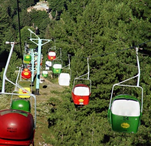
Murree is a popular hill station and a summer resort in Pakistan, Murree is specially for the residents of Islamabad. Murree is also visited as one of the most favourite destination for Pakistani tourists in Sumer and during snowfall of winter.
Murree is located along Islamabad-Kohala highway N75, some 30 km (19 mi) northeast of Islamabad.
The name Murree is derived from 'marhi', "high place" although there is a popular belief it was named after the virgin Mary during the British times
It is situated on the southern slopes of the Western Himalayan foothills as they ascend to the northeast towards Kashmir. During British Rule in the nineteenth century, its altitude was established at 7,000 feet (2,100 m), but its actual altitude has now been determined as 2,300 m (7,500 ft) above sea level.
Murree is accessible by road from the centre of the Islamabad and Rawalpindi areas. It is still associated with Britain; many British fruits (including cherries, raspberries and strawberries) thrive locally. There is a church, built in 1857, located at the centre of the town, which is still used as a place of worship. Many houses around the church are still standing, functioning mostly as hotels. Old traditional restaurants have been replaced by fast food shops and newer restaurants.
Murree has expanded since 1947 at a rate much greater than that which its infrastructure can sustain. Securing water and electricity has been a constant challenge. The jam-packed bazaar has caught fire a number of times in the last century, and the growth of tourism and a construction boom have had an adverse effect on the local environment.
Murree Hotels :
History of Murree
Murree, aftermath of fire in 1875
A 19th century post officeMurree was founded in 1851 by the Governor of Punjab,
Sir Henry Lawrence, and was originally established for the British troops
garrisoned on the Afghan frontier[4] as a sanatorium.
The permanent town of Murree was constructed at Sunnybank in 1853. The church was sanctified in May 1857, and the main road, Jinnah Road, formerly known as The Mall (and still commonly referred to as), was built. The most significant commercial establishments, the Post Office, general merchants with European goods, tailors and a millinery, were established opposite the church. Until 1947, access to Jinnah Road was restricted for "natives" (non-Europeans).
Until 1876, Murree was the summer headquarters of the Punjab local government; after 1876 the headquarters were moved to Simla.[5]
The railway connection with Lahore, the capital of the Punjab Province, made Murree a popular resort for Punjab officials, and the villas and other houses erected for the accommodation of English families gave it a European aspect. It was described in the Gazetteer of Rawalpindi District, 1893�94 as follows:
The sanatorium of Murree lied in north latitude 33� 54′ 30″ and east longitude 73� 26′ 30″, at an elevation of 7,517 feet (2,291 m) above sea level, and contained a standing population of 1,768 inhabitants, which was, however, enormously increased during the [May-November] season by the influx of visitors and their attendant servants and shopkeepers. It is the most accessible hill station in the Punjab, being distant from Rawalpindi only a five hours' journey by tonga dak. Magnificent views are to be obtained in the spring and autumn of the snow crowned mountains of Kashmir; and gorgeous sunset and cloud effects seen daily during the rains [July-August]. Part of the station, especially the Kashmir end, are also well wooded and pretty.[4] Murree also can boast of a world-class educational establishment: the *Lawrence School, Ghora Gali
In 1901 the population of the town was officially 1844, although if summer visitors had been included this could have been as high as 10,000.
In the hot season it was the headquarters of the Lieutenant General of the Northern Command. The Commissioner of the Rawalpindi Division and the Deputy-Commissioner of Rawalpindi also resided here during part of the hot season, for which period an Assistant Commissioner was placed in charge of the subdivision consisting of Murree Tehsil. The site was selected in 1850 almost immediately after the annexation of the Province, and building operations commenced at once. In 1851 temporary accommodation was provided for a detachment of troops; and in 1853 permanent barracks were erected. The garrison generally consisted of three mountain batteries. In 1873, 1874, and 1875 Murree was the summer headquarters of the Punjab Government. It was connected with Rawalpindi town by a service of tongas.
The houses crown the summit and sides of an irregular ridge, commanding magnificent views over forest-clad hill-sides into deep valleys studded with villages and cultivated fields. The neighbouring hills were covered during the summer with encampments of British troops, while the station itself is filled with European visitors from the plains and travellers to Kashmir. A fine view of the snowy peaks of Kashmir is to be had on a clear day, and the crest of Nanga Parbat (26,182 feet (7,980 m)) can sometimes be seen. The municipality was created in 1850.
The income during the ten years ending 1902�3 averaged Rs. 49,500, and the expenditure Rs. 48,200. In 1903�4 the income and expenditure were Rs. 5r,400, chiefly from octroi, and Rs. 54,400 respectively. The income and expenditure of cantonment funds averaged Rs. 10,000 between 1893 and 1903. The chief educational institutions are the Lawrence Military Asylum for soldiers' children, and the St. Denys' and Convent English schools for girls. The station contains the Lady Roberts Home for invalid officers and a branch of the Alliance Bank of Simla. The Murree Brewery was the only industrial concern of any importance.
Dark and Cloudy Murree Landscape[edit] 1857 War of Independence
See also: 1857 War of Independence in Murree
In the summer of 1857, the local tribes of Murree and Hazara, including the
Dhond Abbasi and Tanoli, planned to attack the British Army. The campaign was
led by the chief of the Dhond Abbasi tribe, Sardar Sherbaz Khan, and by Malik
Nawab Bahadur Khan of the Tanoli tribe. They fought respectably against the
British Army, giving the British considerable difficulties. The British Army
eventually signed an agreement with the local Abbasi tribe, which was refused by
the Tanoli tribe, thereby dividing the opposition to the British. The British
Army later ignored the agreement to take control of Murree again.
British presence
After the British forces' occupation of Murree and Abbottabad, many English
soldiers and administrators opted to spend the summers there because of the
cooler climate. The British settled in and raised families. Some prominent
people who were born here include:
Bruce Bairnsfather - a famous cartoonist during world War I
Francis Younghusband - an army officer and explorer. He established the Bible
Society in the Christian High School in Geryal Murree. The society did in depth
research into the local languages. This society translated a chapter of new
testament book Loqas in Dhondi that was noted by the compilers of the
"Linguistic Survey Of India".[8]
Reginald Dyer - officer responsible for the Amritsar Massacre
Murree to Bhurban
Bhurban is celebrated as one of the only resort areas of the country where there is a 5 star hotel built by Pakistan Services Limited, the Pearl Continental Hotel. Bhurban is only 9 Kilometers from Murree and practically it can be called as an area of Murree.
Murre to Nathiagali & Nathiagali to Abbottabad (Tour Excursion)
Nathiagali the famous resort area is only 45 minutes from Murree. The descent on the Nathia Gali - Abbottabad road leads to the city of Abbottabad right under the Murree hills. Abbottabad, a popular summer resort in the midst of spacious valleys, is surrounded by green hills and is a pretty large city and is located at a distance of 116 km from Rawalpindi and 217 km from Peshawar if you follow the MAIN road. It can get pretty hot in summers and pretty cold in winters but the temperature range stays bearable. It may feel hot in the sun but its cool in the shade. Surrounded by high hills, Abbottabad is named after its first British Commissioner Sir James Abbott. It still has a very British air. The Cantonment area of Abbottabad is still very British. The European bungalows, the club, the churches and the cemeteries are still there. Lots of greenery in Abbottabad, beautiful trees and nice gardens.
There is a main road which is the centre of activity (I think its called the Mall). The good hotels are SpringField, Sarban and others. Abbottabad is famous for its golf courses. Take a visit. Also see Shimla Hill View Point, Illayasi Mosque with a natural water spring and there is a pool nearby which I think carries crocodiles. The place has beautiful gardens like; Jinnah Garden, Ladies Garden etc maintained by the local Cantonment Board. The splendid stretch of turf promises plenty of room for polo, football, hockey and golf. At the back of the station towards the west is the Brigade Center, which is an ideal place ideal for walks and picnic. Nice place to stay If you're coming from Lahore to visit the North.
Wildlife in Nathiagali
The Nathiagali region serves as home to all kinds of wildlife; various species of birds, insects, butterflies and animals. Unlike the crows of the southern cities of Pakistan, you will find ravens in areas like Nathiagali. Visitors are advised to sun their bedding on arrival to get rid of bed-bugs, and to keep repellants and pesticides for insects as these have a tendency to show up a lot, especially in old homes, and in the monsoon season.
Horses are a common sight during summer months and are offered to children and adults alike for rides at rates that are often negotiable. Monkeys are aplenty, previously known to be a little shy, they have reportedly become more aggressive in recent years, some say this due to increased abuse suffered at the hands of tourists, who often tease these monkeys or try to steal them. Monkeys often come up to guesthouses and hotels in search of snacks and can be quite noisy and playful.
The World Wildlife Federation has an office in the Galiaath, in recent years, this organisation assisted in the breeding of a certain type of leopard in the Black Forest right by Dungagali and Nathiagali, this area was thought to be a perfect habitat for such creatures, but according to local reports they frequently come out of the forest to steal cattle of local villagers. One such cat had to be shot. Packs of pie-dogs which were previously considered to be a night-time menace can no longer be seen anywhere in the Galiaath, it is thought that most have been killed and consumed by the newly bred leopards. In the summer of 2006, a large number of women were found dead in the deep valleys of Galiath with wounds showing that they were killed, soon, a large leopard was caught which was believed to be the culprit of all cases, he was kept in captivity but was eventually shot as a result of his aggression, his body has been stuffed and kept in the Dhunga Gali Wildlife Museum, the museum owners named him the Ghost of Galiath. These leopards are rarely spotted. However, a pet dog or animal is very likely to be grabbed by the cats at night, and if any such pets are brought to Nathiagali they must be kept indoors to avoid this.
 Thadiani
Thandiani means cold in the local language. Its around about 1 hour and 30 minutes on a good decent road. Its rises steeply at some places. It is 2700 meters above sea level on a small plateau surrounded by pine forests. This beautiful spot can easily be approached from Abbottabad, which is 24 km away. It is totally unspoiled and has the loveliest of views of all the hill stations of Pakistan. The scenery here is breathtaking and superb. It is pretty high. Just a few kilometres into the road and you start gaining height quickly. One place on the road offers a stunning view of Abbottabad city. Thandiani is not located in the Galliat Range but some other range. Beautiful trees on the way and also a few small caves which are probably home for the wildlife.
Thandiani was discovered by the British but was later neglected and was only rediscovered as a hill station recently so it is completely unspoiled. There are few shops at Thandiani and only one basic guesthouse (no big expectations!). It only gets cold about 2 km before Thandiani. There is also a Pakistan Television Booster at the top and a Pak Air-Force Radar (No Photographs). But the beauty of this area is its views. Stunning views of all the areas around this region. Views of the Galliat Range, Hazara Region, Swat Forests, Chitral region and that of Abbottabad itself. Heard the dawn was beautiful but didn't stay at the guesthouse though. Also heard it gets real cold at night even in summers almost below 0 C. Lots of greenery and some beautiful rocks on the ground. There is also a road at the top which seems to go straight into the sky when you first enter Thandiani but it gives wonderful views. Must visit place!
Mirajani peak
Miran Jani is the highest point in the Galliat Range at about 2867 m. It is a very scenic trek to Miran Jani Top which offers wonderful views of the pine forests and hills surrounding the region. The trail to Miran Jani is just behind the Governor's House. You can book horses from Nathia Gali if you dont want to go there by foot.
Dungagali
Dungagali is a picturesque small resort situated on the slopes of the Mukshpuri hill (2376 m.). It commands a charming view of a series of wooded spurs projecting towards the river Jhelum on the western side. From Dungagali one can climb the 2813 m peak of Mukhshpuri, which is the highest point in the range. Natural springs abound on the slopes. It is 30 km from Murree. There are nice hotels available too.
Travel & Culture Services Pakistan
220A Panorama center Fatima Jinnah Road KarachiEmail : Click Here To contact us.
| Home | Pakistan Tours | Conferences & Incentives | Hotels | Airfares | Islamabad | Karachi | Lahore | Peshawar | Quetta |
| Sibi | Faisalabad | Multan | Hyderabad | Sukkur | Hunza | Gilgit | Baltistan | Chitral | Swat | Karakorum Highway |
History of Pakistan | Archeology | Weather | Security | Contact Information |
Advertisement
Advertise on this site click for advertising rates


Kaghan Hotels

Pakistan Tours for Chinese
Tours for Tourists from Thailand
Our Other offices
Dubai Travel & Culture Offerring Tours, Desert Safaris and hotels in Dubai
Sri-Lanka Tours Our Colombo office operating tours in Sri Lanka
Qatar Travel & Culture Tours and travel information about Qatar
Malaysia Travel & Culture Tours and hotels in Malaysia
中文网站 Read this website in Chinese
More offices Details about our company and other offices